Now and then: Damage to quake-hit area in Sichuan
chinadaily.com.cn |
Updated: 2017-08-12 10:00


Share


Share - WeChat


Satellite remote sensing images
Now: An image taken on Aug 9, 2017
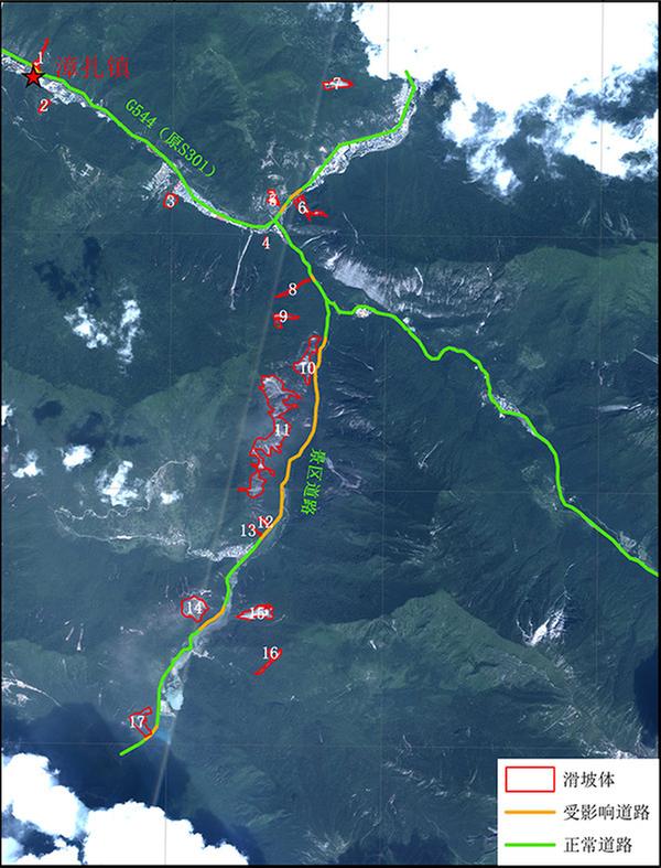 |
| Red: landslide mass; Yellow: Affected roads; Green: Unaffected roads [Photo/Xinhua] |
Then: An image taken on Jan 15, 2017
 |
| Green star stands for Zhangzha county. [Photo/Xinhua] |
 |
| Green star stands for Zhangzha county; the red circle stands for the epicenter. [Photo/Xinhua] |
Related Stories


- PLA drills around Taiwan a necessary response, expert says
- PLA begins large-scale drill around Taiwan Island
- China reports achievement in forestry, grassland germplasm resources conservation
- PLA conducts live-fire training in areas north, southwest of Taiwan Island
- PLA conducts training of assault on maritime targets to east of Taiwan Island
- Fujian Coast Guard conducts comprehensive law enforcement patrols in the waters surrounding the vicinity of Taiwan Island